For most of Western Australia, the best time to get out on trail is April to November, depending on weather conditions. These months generally offer cooler temperatures and safer conditions for hiking and trail running.
Summer (December to March) is usually not recommended for multi-day trips. Extreme heat, limited shade, and remoteness make even short outings risky if you’re inexperienced.
Seasonal Differences Across WA
South West & Mid West: April–November is typically ideal
Northern WA (from Carnarvon north): The safest window is winter (June–August)
Even in winter, temperatures in places like Broome can still reach 30°C during the day, so heat management is always important.
As a general rule, days with a forecast maximum below 30°C offer the most enjoyable and safest experiences, especially for beginners.
Why the Landscape Matters More Than the Forecast.
In WA, the landscape you’re travelling through can dramatically affect how hot or cold it feels—sometimes far more than the forecast suggests.
Even if you plan to finish early, heading out in hot conditions can be risky.
Hot, Exposed Environments
Areas with:
- Little or no shade
- Large amounts of rock
- Dry, reflective surfaces
can be significantly hotter than forecast.
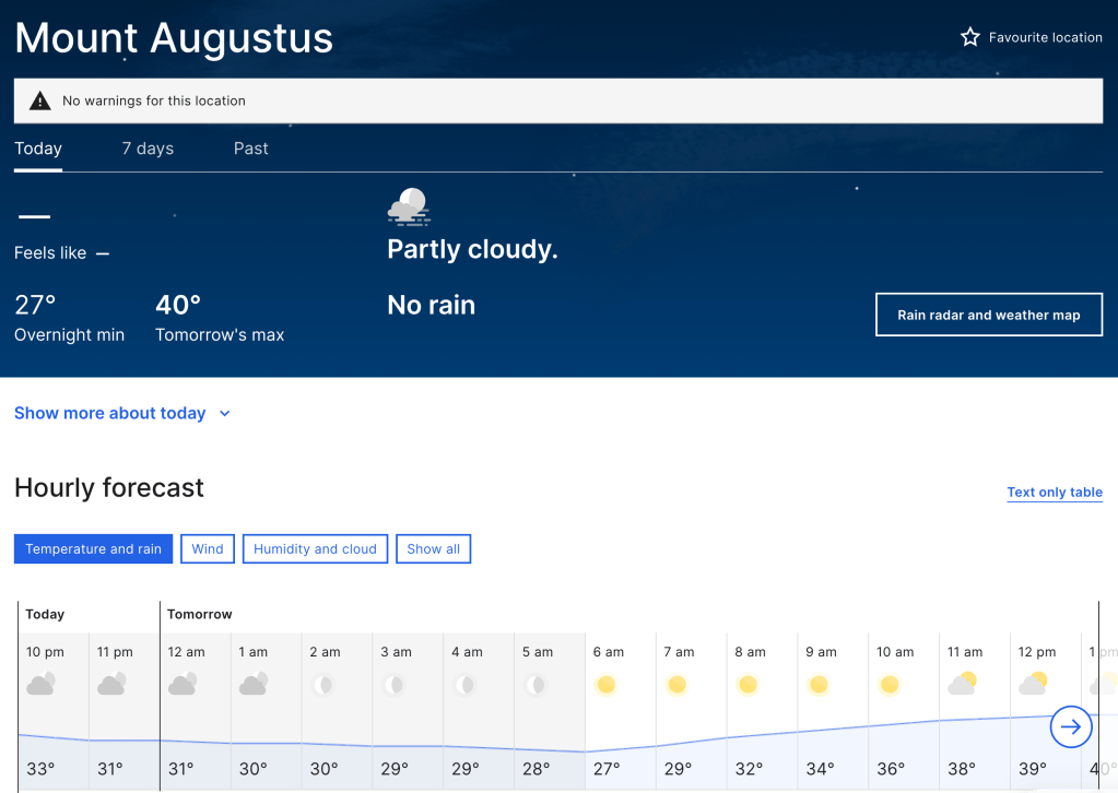
Good examples include Mount Augustus (Burringurrah) and coastal granite areas near Esperance.
When travelling on heat-retaining surfaces like rock:
- Ground temperatures can exceed air temperatures by 50% or more
- A forecast of 30°C can mean 45°C+ at ground level
Without adequate shade, water, electrolytes, and appropriate clothing, these conditions can quickly become dangerous. Knowing when to turn back is critical.
Sadly, several people in recent years have died from heat-related illness while attempting to summit Burringurrah. This risk is real and often underestimated by those new to hiking.
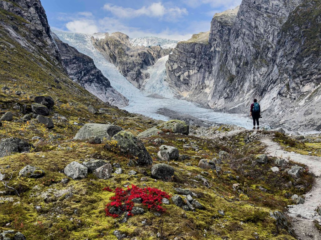
Cold, Wind, and Rapid Weather Changes
At the other extreme, mountainous and sub-alpine environments can catch people out just as easily.
The Stirling Ranges are well known for creating their own weather systems.
A forecast of sunny and 25°C at ground level can quickly turn into:
- Heavy rain
- Whiteout conditions
- Winds exceeding 60 km/h
Many hikers climb Bluff Knoll without wet-weather gear, only to become soaked, cold, and at risk of hypothermia.
The Stirling Ranges are one of the most frequently attended locations for search and rescue call-outs in Western Australia.
Bushfire Risks and Weather Forecasts
Bushfire Risk: Not Just a Hot-Day Problem
Heat isn’t the only summer danger—bushfires are a serious risk, even on mild days.
Dry vegetation combined with strong winds can allow fires to spread rapidly, cutting off access roads and escape routes.
Before every hike or run:
- Have a plan to turn back early
- Check current conditions
- Be aware of total fire bans
What to Check Before You Go
For every trip—short or long—make this part of your routine:
- Download and check the Emergency WA app
- Review weather warnings from the Bureau of Meteorology
- Consider temperature, wind, rain, and fire danger—not just sunshine
- Pack for worse conditions than forecast
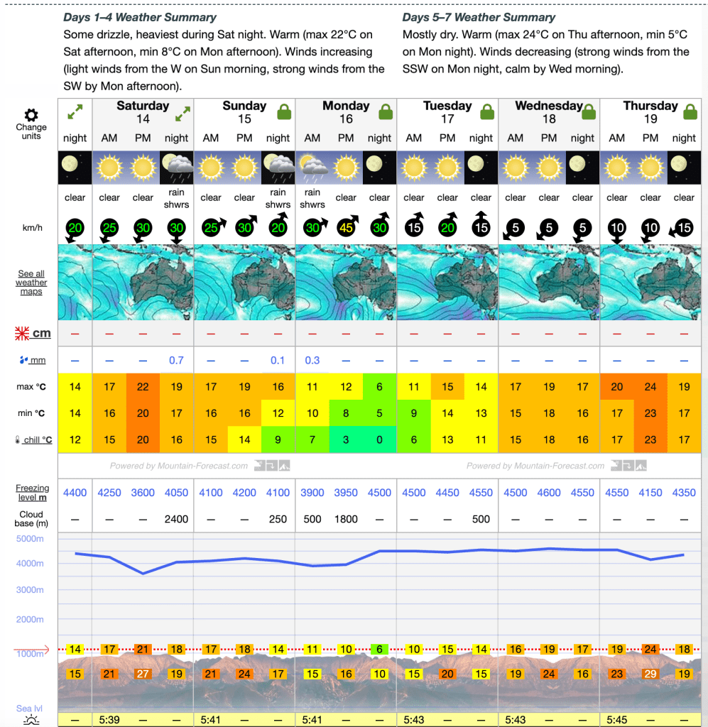
Weather forecast resources